Olsbrücken - Teufelstour
Supported by 1. FCK, (the local football team club) the path was signposted using the devil’s emblem from the FCK’s stadium Betzenberg.
The mix of wild and romantic river valleys, steep climbs and a breathtaking view over the Palatine Uplands and the Palatinate Forest right up to the Donnersberg, makes the “devil’s tour” with its 15 km total length into a unique discovery tour of the Palatinate.
On narrow paths and trails which have hardly changed in the course of time we have the opportunity of passing through almost 300 million years of geological history. Passing both old and still active stone quarries, ambitious hikers can inform themselves on several geological information boards set up by the State Office for Geology and Mining.
For active recreation whilst hiking you should not forget to stop and take a break. Along the Teufelstour you will find many beautiful places to rest and linger. The Panorama-Gasthof Emmerwiesenhof in Eulenbis , for example, is situated directly on this premium hiking trail.
In "Fossils worldwide", Hebelstraße 4 in Sulzbachtal the geological subsoil can actually be felt. This exhibition is constructed as both a sales and museum vicinity. A wide range of minerals and fossils, which partly come from the immediate vicinity of the Sulzbachtal , are on display.
Route description
Olsbrücken (Walking station) – Road “Am Bahnhof” after Nordwesten – At the street (the right turns on the rails) turn left, up the path – Steilrech – Tiefental – Teufelstein – Sonnhaller Wald – Platte – Steinbruch Sulzbachtal – Schlucht im Dieterswald – Eulenbis (Friedhofstraße) – turn left – Panorama-Gasthof Emmerwiesenhof (Einkehrmöglichkeit) – turn right – Schwarzwald – Hirschhorner Bordenmühle – Lautertal – railway station Untersulzbach
Please note: There is a connecting route between the municipalities of Sulzbachtal and Olsbrücken. The arrow signs with a yellow tip mark the route between the centre of Sulzbachtal (village well) and the Wanderbahnhof in Olsbrücken.
")
")
")
")
")
")
")
")
")
")
")
")
")
")
")
")
")
")
")
")
")
")
 (Dominik Ketz)")
")
")
")
")
")
")
")
")
")
")
")
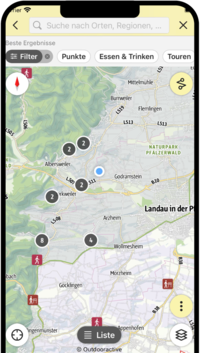
SÜW-App
Use our app as an interactive holiday planner:
- Detailed topographic maps
- Precise map base, also available offline
- Highlight recommendations from us for you
- Exact tour descriptions
- accessibility Informations
- Refreshments and overnight stays
- Sights and events
- Navigation function including voice output
- Planning your own tours at home
- Tracking your own tours on the go
- Get to know the environment better with skyline augmented reality