Brunnenweg - predicate hiking trail from Esthal
The Brunnenweg, is divided into two sections and is marked with its own hiking sign. The starting point of the hike is the village square in Esthal.
The 15 km long Brunnenweg leads around Esthal near Lambrecht (Palatinate) - with its many historic wells, which used to be mainly used as cattle watering places and washing wells. Immerse yourself in the Palatinate Forest and enjoy the fresh spring water from the Goldbrunnen - or linger over a picnic, at the 250-year-old Straufelsbrunnen. This was still used by the "Eschdler" citizens until the 1950s. Enjoy Palatinate hospitality in the idyllically situated Wolfsschluchthütte.
UFFBASSE! - Campaign for considerate coexistence in nature
- Always behave in a forward-looking, friendly and considerate manner towards everyone you meet along the way.
- Respect nature, do not destroy plants and always stay on the paths.
- Try to avoid excessive noise and leave the forest before dusk.
- Remember to bring a rubbish bag for the road and take rubbish home with you.Please keep your dog on a lead at all times. Other visitors and animals will thank you.
- For your own safety, observe all trail closures.Park only in designated parking areas.
- Leave space for emergency vehicles and agricultural machinery.Please give priority to agricultural and forestry traffic.
Route description
The Brunnenweg, divided into two sections, has its own hiking sign. The start of each loop is at the village square in Esthal near the church. 1.
1. we walk past the community centre in the direction of Entengasse. Immediately after the sandstone house, a meadow path leads past orchards into the valley to the Straufelsbrunnen fountain. A refreshment before continuing on the path up to the Aschberg is very good for you. At the end of the ascent, the path leads to the right along the Rosenkranzpfad. At the end of the Rosenkranzpfad, turn left past the Waldfesthalle and the Esthal monastery to Tannenstraße. Here a short meadow path leads back into the forest and down the hill to the K23. Cross this carefully and continue into the Hengstental valley with its newly constructed fountain. Above the Hengstental, the path continues to the Wögelsbrunnen.
Leave the fountain in the direction of the road and walk down the steps at the sports centre to the path on the opposite side. Follow this path to the right and past meadows. Soon you will see the drinking fountain on the right below the road.
Shortly afterwards, walk back through the village to the village square.
2. the second loop leads down the mountain road and immediately after the last houses turn right along the meadow path to the Nebelsbrunnen. From here the path continues left through the Nebelstal valley until it branches off to the right at the start of the forest towards the Römerbrunnen fountain. Once at the Römerbrunnen, we descend into the valley of the Breitenbach to the Goldbrunnen. This is a spring where the water presses through the sand from below. As a result, the surface is quite calm, although the spring supplies a lot of water. From here, take the path uphill on the opposite side of the valley to the Erntsiegelbrunnen (harvest seal well). On the way there, it is worth taking a short detour to the viewpoint on Esthal (Esthaler Blick). After the Erntsiegelbrunnen (harvest seal fountain), the trail leads back to the village via the Wolfsschluchthütte, which invites you to take a break at weekends and on Wednesdays, and the Schelmenteichbrunnen (pond fountain).
")
")
")
")
")
")
")
 (Harald König)")
")
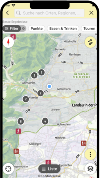
SÜW-App
Use our app as an interactive holiday planner:
- Detailed topographic maps
- Precise map base, also available offline
- Highlight recommendations from us for you
- Exact tour descriptions
- accessibility Informations
- Refreshments and overnight stays
- Sights and events
- Navigation function including voice output
- Planning your own tours at home
- Tracking your own tours on the go
- Get to know the environment better with skyline augmented reality