Annweiler Richard-Löwenherz-Weg
From the town hall square in Annweiler's town centre, the trail leads out of town through Gerbergasse via Südring. Past the Trifelsruhe and the Wasgaublick, the climbers' hut at the imposing rock massif Asselstein offers a rustic place to stop. Via the Rehberg car park, head up to the right to the lookout tower on the Rehberg. The climb is worth it, as the view over the Pfälzerwald-Nordvogesen Biosphere Reserve and the castles of Trifels, Anebos and Scharfenberg (Münz) is breathtaking. On the way down to the Rehberg car park, you pass the Rehbergquelle, an appealing resting place with a refuge. At the trail spider below the climbers' hut, the lion's heart marking leads to the right, down into the Bindersbach valley. At the Art Nouveau Hotel Trifels, the path turns left and leads along the Markwardanlage (park) via Burgstraße and Hauptstraße to the starting point of the hike at the town hall.
UFFBASSE! - Campaign for considerate coexistence in nature
- Always act with foresight, kindness and consideration towards everyone you meet on the way.
- Respect nature, do not destroy plants and always stay on the paths. Try to avoid excessive noise and leave the forest before dusk.
- Remember to bring a rubbish bag for the road and take rubbish home with you.
- Please keep your dog on a lead at all times. Other visitors and animals will thank you.
- For your own safety, observe all road closures, even at weekends.
- Park only in designated parking areas. Leave space for emergency vehicles and agricultural machinery. P
- lease give priority to agricultural and forestry traffic.
Gestern · Sperrung · Asselstein
Aus Natur- und Artenschutzgründen ist der Asselstein zum Klettern derzeit gesperrt.
Die meisten Sperrungen erfolgen aus Gründen des Vogelschutzes und sind daher auf den Zeitraum der Vogelbrut, Beginn 1.2., bis 01.06. (Kolkraben) bzw. 01.07. (Wanderfalke und Uhu), beschränkt.
Sollte ein Fels “unbewohnt” bleiben, dann kann die Sperrung auch schon vorher aufgehoben werden. Dies wird dann hier auf der Homepage angekündigt und der entsprechende Fels erscheint dann nicht mehr in dieser Liste.
Route description
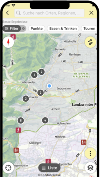
We start at the town hall in Annweiler am Trifels, first turn north and then turn into the picturesque Gerbergasse at the old water mill. Then we pass the Annweiler hospital on the left and continue along a footpath to the Südring. Cross this diagonally to the right and ascend via Brunnenring until you reach the street "Zum Honigsack". After a few metres, an easily overlooked meadow path branches off to the right, which turns into a forest path and leads us up the Klingelberg. Keeping to the right at the next two crossroads, we walk along the western flank of the ridge. Our path joins a wider hiking trail, which we follow to the right for a short while, only to leave it again to the left at the next opportunity. The path leads us steeply upwards in serpentines through the Annweiler municipal forest and the beautifully designed grounds of the Trifelsruhe natural burial site.
We pass the vantage point at the Willi-Achtermann-Hütte with a magnificent view of the Reichsfeste Trifels and continue along the hiking trail to the Wasgaublick vantage point. Here the name says it all and we enjoy the distant view over the green waves of the southern Pfälzerwald. We hike on a wider grassy path in a north-easterly direction. On a small forest path branching off to the right, we descend steeply to the road. The markings now guide us to the impressive Asselstein rock massif and on to the climbers' hut, a welcome place to stop for refreshments (closed on Mondays and Tuesdays).
From the nearby hikers' car park, we make a detour to the lookout tower on the Rehberg. The view from the Rehberg tower is breathtaking. In between, we discover the three castles Trifels, Anebos and Scharfenberg (Münz) as well as the Asselstein we just explored. After this detour, we follow the path downhill, past the Rehberg spring, back to the Rehberg hikers' car park. Here we keep to the right in a northerly direction, then turn right again at a large clearing with a magnificent view of Trifels Castle and zigzag down into Bindersbach Valley. There we finally reach Annweiler am Trifels through the idyllic valley and the Markwardanlage (park). At the end of the park, we turn left through Burgstraße and Hauptstraße back to Rathausplatz, our starting point.
If you want to shorten the tour a bit, you can also start at Trifelsruhe (there is a car park and a bus stop). Then follow the path up to Wasgaublick, on to Asselstein and the climbers' hut. If you like, you can still take the loop to the Rehbergturm. At the junction below the climbers' hut, however, you then leave the Richard Löwenherz Trail to hike back to Trifelsruhe (the connecting trail is signposted from the junction).
Distance round Löwenherzweg from Trifelsruhe without Rehberg 4.5 km, with Rehberg 8.5 km.
")
")
")
")
")
")
")
")
")
")
")
")
")
")
SÜW-App
Use our app as an interactive holiday planner:
- Detailed topographic maps
- Precise map base, also available offline
- Highlight recommendations from us for you
- Exact tour descriptions
- accessibility Informations
- Refreshments and overnight stays
- Sights and events
- Navigation function including voice output
- Planning your own tours at home
- Tracking your own tours on the go
- Get to know the environment better with skyline augmented reality