Petronella Cycle Route
The cycle route leads gently downhill from Bad Bergzabern all the way to Wörth am Rhein. Before setting off, you can recharge your batteries with a wellness treatment in the Südpfalz Therme spa. The “Cattle Line” then takes you to Kandel, where anyone of an adventurous disposition can have a go on a climbing course in the Fun Forest Adventure Park. Those who prefer a quieter life might enjoy a shopping trip in Kandel or a spot of relaxation in Wörth Bürgerpark, which also features a sculpture garden. Featuring flat paths, the Fun Forest, and an adventure playground in Wörth, this route has plenty of activities to keep the children entertained.
UFFBASSE! - Campaign for considerate coexistence in nature
- Be considerate when out and about - Always act with foresight, kindness and consideration towards everyone you meet along the way. This is especially true on farm roads where winegrowers, farmers and foresters work, even at weekends.
- Picnic & rubbish - Remember to bring a rubbish bag for the road and take rubbish home with you. Only use the furnished rest areas for breaks and picnics.
- Conservation - Stay on designated trails and avoid unnecessary noise when out in nature. Leave the forest at dusk at the latest to avoid disturbing the rhythm of nocturnal animals.
Route description
We start in Petronella Straße in Bad Bergzabern, on the corner of Theodor-Heuss-Straße. Follow Theodor-Heuss-Straße for around 200 metres and then turn left into Pestalozzistraße. After approximately 400 metres, turn right into Friedrich-Ebert-Straße. At the end of this street, turn left onto an agricultural road and then left again into Steinfelder Straße after a short distance. We continue over the roundabout, taking the second exit and leaving Bad Bergzabern behind us. The next 11 kilometres take us past vines and fields before arriving in Minfeld. We turn left immediately after the cemetery, cycle past Schoßberghof farm shop and follow the route until just outside Kandel. We initially ride alongside the Dörniggraben river, following Hubhofweg and Jahnstraße before we turn right into Lauterburger Straße. We turn left when we reach Elsässer Straße. The route continues through Scheidwald forest towards Wörth. We turn right before Badepark Wörth water park and turn left again into Lisztstraße after 700 metres. At the end of the street, we turn right into Richard-Wagner-Straße and then left again into Hanns-Martin-Schleyer-Straße, which becomes Bahnhofstraße after approximately 3 kilometres. Passing the Wörther Altrhein river, we follow the road and finally reach Maximilianstraße and Rheinstraße on the banks of the Rhine, where the tour ends.
")
")
")
")
")
")
")
")
")
")
")
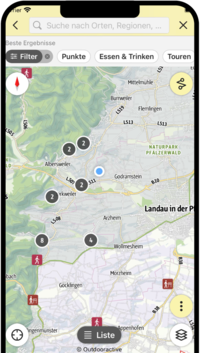
SÜW-App
Use our app as an interactive holiday planner:
- Detailed topographic maps
- Precise map base, also available offline
- Highlight recommendations from us for you
- Exact tour descriptions
- accessibility Informations
- Refreshments and overnight stays
- Sights and events
- Navigation function including voice output
- Planning your own tours at home
- Tracking your own tours on the go
- Get to know the environment better with skyline augmented reality