Dimbacher Buntsandstein Höhenweg - GEOpfad with 12 information boards
Not just for rock “connoisseurs”, this circular route is a feast for all your senses. Colourful and bizarre rock formations line the ten kilometre long hiking trail that leads mostly on the plateaus surrounding the village of Dimbach. The diverse ups and downs of the trail are a unique combination, no matter from which direction you start. Arriving at the top height of the trail it now winds around huge rock formations for a number of kilometres. Those who do not suffer from vertigo have plenty of opportunities to climb some rocks on narrow paths and enjoy unique views from the top.
It is highly recommended to look around each viewpoint, since other narrow paths often lead to nearby secluded spots with hidden views.
After a few strenuous climbs, you reach the first lookout point: the rock massif of Falkenstein. After a detour to Kaftenstein - overlooking the village of Dimbach – you continue at the same height past even more impressive rock formations. A quaint Marien-Gedenkstätte (memorial site) invites you in for a meditation on your way to Dimberg . After a short climb to the summit of the Dimberg, you can enjoy a sublime view of the deep valley below. In warm and sunny weather you will not be up here by yourself since lizards scurry around and sunbathe on the rocks.
Once back on the trail, our next destination is the Rötzenberg with its mighty Rötzenfelsen. On the way we pass the Isselmannsteine. A good physical condition is required for the ascent to the Rötzenberg, but the effort is well worth it since on the rocky plateau you can enjoy a magnificent view over the Palatinate hillsides (closed to walkers and climbers from April to the end of June to protect the peregrine falcons which live here). Here you can take a break and fortify yourself for the onward march to the Kieungerfelsen. On the way you will notice the changes in the colours and textures of the sandstone. Bright red tones and different coloured rock formations dominate the scene along this light-filled stage. Once on the Kieungerfelsen you are bound to think that you are somewhere in the south of Europe: conifers exude a sweet fragrance whilst soft ground and flat plateaus invite you to rest. Up here you can away from it all, enjoy the tranquility and listen to the sounds of nature.
From Kieungerfelsen onwards the path towards Häuselstein meanders past huge, moss-covered stones and rocks, where you can scramble around. In between lies the Horn-Gipfel, a climb up to the the summit of which requires a good physical condition. Having left the Immersberg behind you, there is a comfortable sitting area at the Häuselstein with a view of the valley. From here we go down a switchback path leading to a quiet, secluded spot.
Now it's back down the hillside towards Dimbach. The last rock attraction, the Keeshäwek is the end of the somewhat strenuous but rewarding Buntsteinhöhenweg. Now there are only about two kilometres to the parking lot at Dimbach, the starting point of this three-hour hike. Who does not want to do the entire hike but still see the impressive highlights has the option of changing to a trail marked with a blue cross at the Gosserweiler Schüthütte - between Rötzenberg and Kieungerfelsen - in order to make it back to Dirnbach on a shorter trail.
Route description
Dimbacher Buntsandstein Höhenweg - now with an even more attractive route from the Immersberg This circular hiking trail is a feast for the senses, and not just for rock connoisseurs. Even the less knowledgeable will get their money's worth: Colorful, bizarre rock formations line the approximately ten kilometer long hiking route, most of which leads over the plateaus around the village of Dimbach. The Höhenweg reveals itself like a composition of several acts, regardless of which direction you start from. Once at the height, the path winds for kilometers around huge rock massifs. Those who do not suffer from fear of heights have ample opportunity to climb some rocks over narrow paths and enjoy unique views from there. It is highly recommended to inspect the closer surroundings of the viewpoints, because narrow paths branching off often lead to nearby secluded spots with hidden views. After a few athletic meters you reach the first vantage point on the high trail: the Falkenstein rock massif. After a detour to the Kaftenstein - with a view of the village of Dimbach - the route continues on a high level, past impressive rock formations. A pretty Marien memorial invites you to a prayer on the march to Dimberg. After a short climbing tour, a sublime view of the valley below is presented from the summit of Dimberg. In warm, sunny weather you are not alone up here: lizards scurry around and sunbathe on the rocks. Back on the hiking trail, the next destination is on: the Rötzenberg with the mighty Rötzenfelsen. On the way you will pass the Isselmannsteins, among other things. A good physical condition is required for the ascent to the Rötzenberg. But the effort is worth it: On the rock plateau, which is closed to hikers and climbers from April to the end of June to protect the peregrine falcons, you can enjoy a magnificent view of the Palatinate mountains. Here you can comfortably take a break and strengthen yourself for the march to the Kieungerfelsen. If you direct your gaze to the rock formations along the way, you will notice the changes in the colors and structures of the sandstone. Luminous red tones and differently colored layers of rock shape the picture on this light-flooded section of the route. When you arrive on the Kieungerfelsen, you think you are somewhere in the south of Europe: Conifers give off their sweet scent, soft ground and flat plateaus invite you to take a break. Up here you leave everyday life behind, enjoy the peace and quiet and listen to the sounds of nature. From the Kieungerfelsen, the path meanders towards Häuselstein past huge, moss-covered stones and rocks, some of which you can scramble around on. In between is the Horn summit, the ascent of which again requires a good level of fitness. If you have left the Immersberg behind you, a seating group on the Häuselstein invites you to take a leisurely rest with a view of the valley. From here a winding path descends that leads to a quiet, secluded spot. Now it's back downhill towards Dimbach. With the Keeshäwel, the last rock attraction, the adventurous and impressive tour on the Buntsandstein-Höhenweg ends. Now it is only about two kilometers to the parking lot in front of Dimbach, the starting point of the three-hour hike. If you don't want to hike the Höhenweg entirely, but don't want to miss out on the impressive highlights, you can switch to the hiking trail with the blue cross at the Gossersweiler Refuge - between Rötzenberg and Kieungerfelsen - to get back to Dimbach over a short distance
Text: Daniela Trauthwein
")
")
")
")
")
")
")
")
")
")
")
")
")
")
")
")
")
")
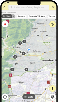
SÜW-App
Use our app as an interactive holiday planner:
- Detailed topographic maps
- Precise map base, also available offline
- Highlight recommendations from us for you
- Exact tour descriptions
- accessibility Informations
- Refreshments and overnight stays
- Sights and events
- Navigation function including voice output
- Planning your own tours at home
- Tracking your own tours on the go
- Get to know the environment better with skyline augmented reality