Pälzer Keschdeweg - main trail
The hike begins at the German Shoe Museum in Hauenstein. Through the Palatinate Forest, past rocks and meadows, through Lug and Wernersberg, the first stage leads to Annweiler am Trifels. On the second stage, past the Windhof farm and along the Cramerpfad trail in the direction of Madenburg Castle, you reach Eschbach an der Weinstraße. The ruins of Neukastell with a magnificent panoramic view can be reached via Leinsweiler and the Slevogthof. The route continues leisurely to Albersweiler.
The third stage leads along the Wine Road to Villa Ludwigshöhe Castle and Edenkoben. The fourth and last stage leads past the peace monument and the Kropsburg to St. Martin. The route continues up to Hambach Castle, the cradle of German democracy. Now you hike down to Neustadt an der Weinstraße, the end point of the tour.
Route description
The hiking trail, which is a good 65 km long, takes you through the Pfälzerwald-Nordvogesen biosphere reserve into the wine country of the German Wine Route. Along the way, the trail repeatedly passes through chestnut forests that stretch along the edge of the Palatinate Forest in a wide strip parallel to the Wine Road.
Further information on the hiking trail, on accommodations and places to stop for refreshments, and on events related to the sweet chestnut in the southern Palatinate can be found at www.keschdeweg.de.
In addition to the main trail, Keschde Trail hikers can also discover two other Keschde Trail tours: the Enjoyment Tour from the St. Anna Chapel to Weyher and the Palatinate Forest Tour from Albersweiler via Dernbach and Ramberg to the Swiss House near Weyher.
Stage for the day Hauenstein-Annweiler (14 km)
The starting point of this stage is the German Shoe Museum in Hauenstein. At the museum you first walk uphill and through the residential area until you reach the edge of the forest. You then hike past bizarre rock formations such as the Runden Hut and the Hornstein via Lug and Wernersberg to Annweiler am Trifels. Along the way, always follow the "Chestnut" markings. Between Lug and Wernersberg, it is worth taking a detour to the Geiersteinen (vulture stones), which offer a beautiful view over the Wasgau region. In Wernersberg you hike past a small chapel into the village, walk on the main road briefly left and right again up to the forest. Then continue through a beautiful chestnut forest on narrow paths down to Annweiler am Trifels. In Annweiler, after a residential area, you will pass through the historic town center, through Gerbergasse to the town hall and the town church.
Stage for the day Annweiler-Albersweiler (17 km)
From the town hall square in Annweiler, you continue along Burgstraße in the direction of the spa gardens. Parallel to the Kurpark, the trail leads up to the Windhof and along the Cramerpfad (note the detour in August 2018) in the direction of Madenburg Castle. A detour to the castle complex is always worthwhile, especially since there is also a castle tavern. The Keschde trail leads below the Madenburg down to Eschbach and then through the vineyards to Leinsweiler. Past the pretty winegrowing village, we hike up to the Slevogthof and on to the ruins of Neukastell. Here you have a wonderful panoramic view over the Palatinate Forest and the Rhine plain. Afterwards, we walk over the Hexentanzplatz to the Zollstock wayside cross and continue through woods and meadows to Albersweiler.
Stage for the day Albersweiler-Edenkoben (12 km)
We cross Albersweiler on the German Wine Road and hike up the Kanskircher Straße to St. Johann. Here you can visit the excavations of an old monastery. We follow the Schloßstraße, which leads us into the vineyards. We continue along the edge of the forest past the winegrowing villages of Frankweiler and Gleisweiler. In Gleisweiler the path passes the sanatorium. The trail continues in the direction of Burrweiler. With a beautiful view of the St. Annakappelle, the path leads past the chapel. Now the trail continues to Weyher, then to Villa Ludwigshöhe.
At this stage there are possibilities for additional round trips:For the Palatinate Forest tour, you leave the main trail in Albersweiler- St. Johann with the "Kastanie 3" marker in the direction of Dernbach and then hike via Dernbach, Ramberg and the Three Beeches to Weyher, where you rejoin the main trail and can use it as a return route to Albersweiler. Between Dernbach and Ramberg you will see several ruins: Neuscharfeneck, Ramburg and Meistersel.With the marker "Kastanie 4" you walk the enjoyment tour between Weyher and Burrweiler.
Stage for the day Edenkoben-Neustadt (17 km)
The last stage leads from castle to castle. From Villa Ludwigshöhe, the route continues via St. Martin to Hambach Castle and on to Neustadt an der Weinstraße, where the trail ends at the train station.
")
")
")
")
")
")
")
")
")
")
")
")
")
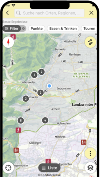
SÜW-App
Use our app as an interactive holiday planner:
- Detailed topographic maps
- Precise map base, also available offline
- Highlight recommendations from us for you
- Exact tour descriptions
- accessibility Informations
- Refreshments and overnight stays
- Sights and events
- Navigation function including voice output
- Planning your own tours at home
- Tracking your own tours on the go
- Get to know the environment better with skyline augmented reality